Sanborn Fire Insurance Maps
Sanborn Maps in Fisher Fine Arts Library
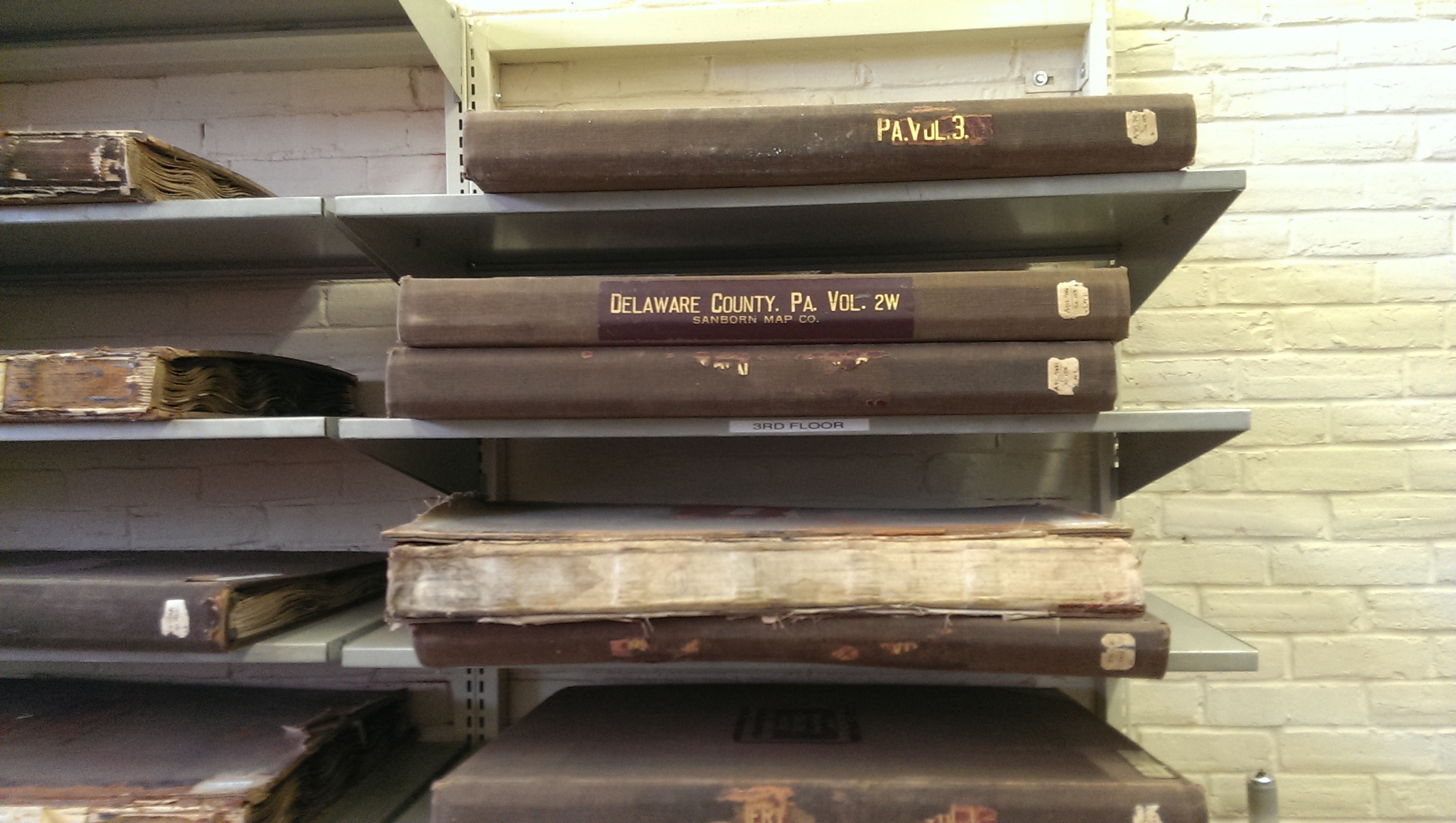
In the middle of May 2014, I started working in the Fisher Fine Arts Library as interim head. In the weeks leading up to my first day, I had three or four meetings with the departing head of the library. During one of these meetings, he gave me an extended tour of the library. There are four floors of stacks, and the top floor houses, among other things, the “folios”—the larger volumes that don’t fit on regular library shelving. Some of the volumes are so big they’re shelved on their sides.
As we were passing through this folio area, the head librarian pointed out two shelving sections containing Sanborn Fire Insurance Maps that had been purchased for a reasonable price at a local flea market and then sold to the library.
The volume with “Delaware County” on its spine caught my eye, and I made a mental note to return to the fourth floor to have a look at it. A week later, I returned to the fourth floor and pulled down the volume. It was one of several volumes devoted to Delaware County. Here’s the title page of the volume that contains a map of Heatherwold.
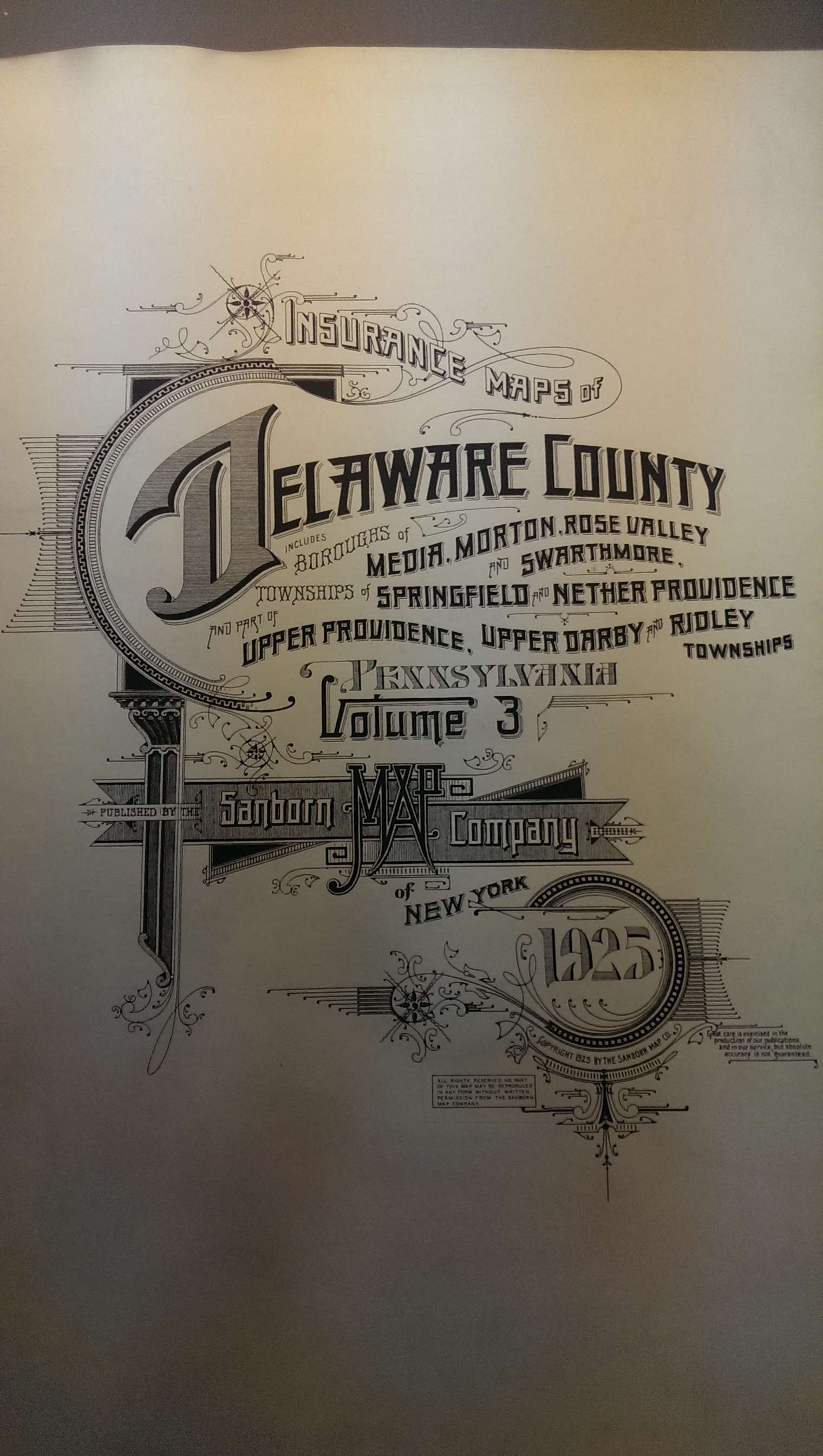
Title page of volume 3 of Sanborn Maps
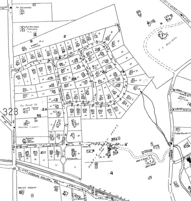
The date on the title page is 1925—more than a decade before Heatherwold was built—but when I turned to the map for the neighborhood, all of the houses built in 1939 were shown.
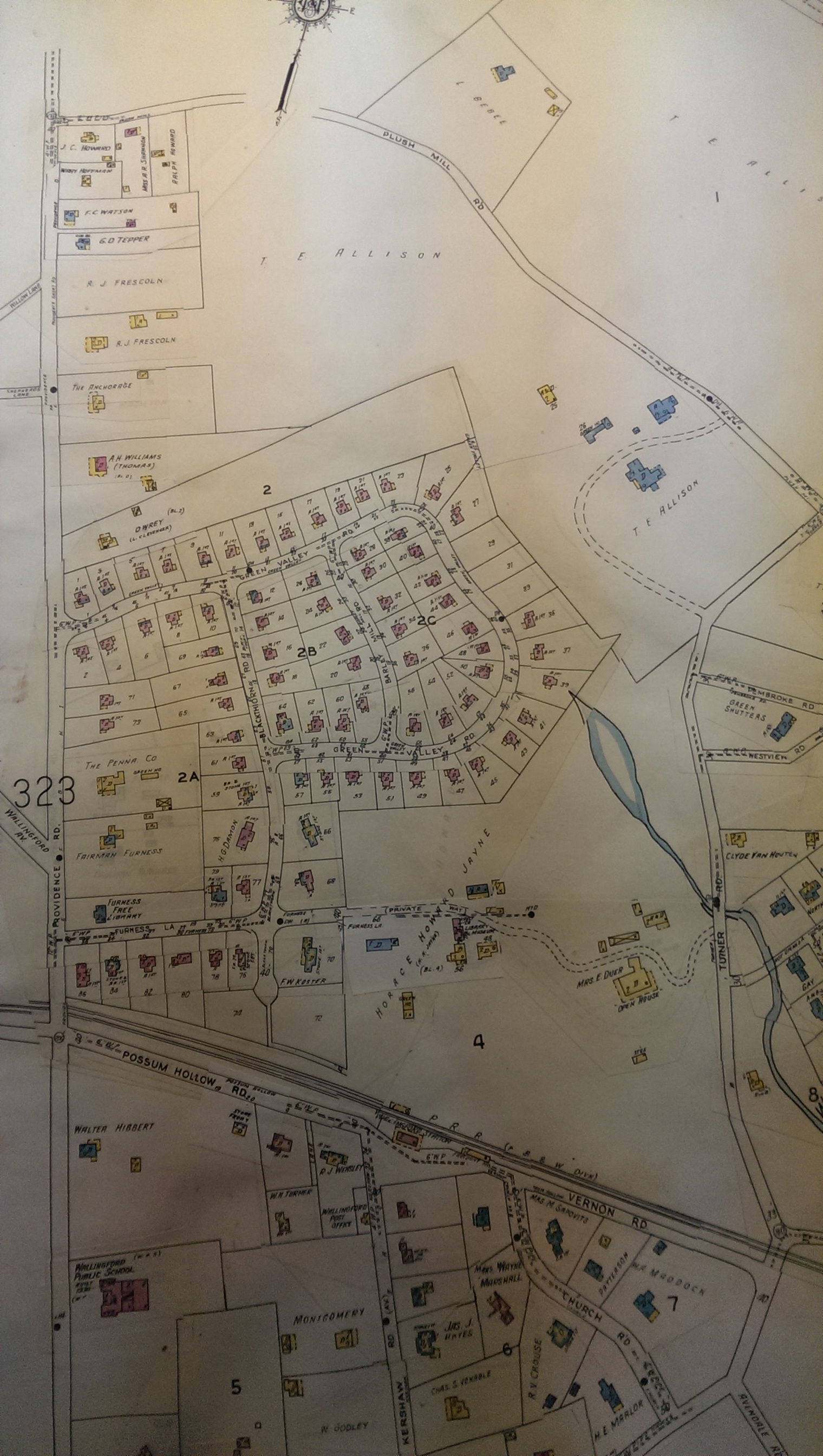
Heatherwold in the Sanborn Maps
Why were these houses built in 1939 showing up in a volume published in 1925? I learned from the Library of Congress site devoted to the Sanborn Maps that updates were issued to the 1925 volumes in the form of pasteovers. If you look closely at the image of Heatherwold, you’ll see the edges of the pasteover, and you can also see ghost images of what the pasteover covered.
These pasteovers and the ongoing update they provided makes it very difficult to determine the true date of these maps. The pasteovers aren’t dated, so it’s difficult to determine when the updating ceased. Based on what we know about the construction date of the houses, this map was last updated sometime between the 1940s (when Lindenshade was torn down) and 1965, when 29, 31, and 33 Green Valley Road were constructed.
The colors of the buildings indicate the materials used for their construction, which was valuable information for fire insurance agencies. A key to the color codes is provided on the Library of Congress site.
South of Heatherwold, you can see the buildings that make up Lindenshade and Subrosa (which seems to have been named “Open House” at the time this map was updated). Some new buildings had been added to Lindenshade after the initial publication in 1925, and the driveway through Sub Rosa was rerouted. The real puzzle, though, is why Lindenshade is showing up at all in a map that is dated 1951, since the main house was supposedly demolished in 1940 (according to a Library of Congress site; yet see this account by author Barbara Ross that makes it clear a substantial part of the estate was still standing in the early 1960s). And just east of Heatherwold is the T. E. Allison estate and its large main house, Cony Meade, which became notorious in the 1970s and 1980s as “the Castle”, home to a motorcycle gang involved in drug deals and whose members allegedly murdered as many as four women in the house.
I learned several things from this map. Apparently Dick’s Run, the stream that flows behind the houses on the east end of the subdivision, was pooled (by way of a dam?) just southeast of 39 Green Valley Rd. I haven’t seen this body of water represented on other maps. Also, quite a few buildings were added to the Lindenshade estate between 1925 and whatever date it was demolished.
The Library of Congress and Pennsylvania State University offer scans of many of these Sanborn Map volumes, and here are scans for the pages showing Heatherwold, first from the unrevised 1925 edition (from Penn State), and then from a volume updated through 1951 (from the Library of Congress; this scan has since been taken down by LC, presumably for copyright reasons).
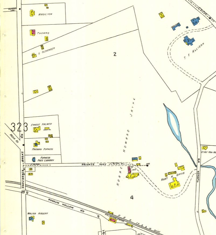
Pennsylvania State University color scan of the 1925 Sanborn Map for Heatherwold
Library of Congress black-and-white scan of the 1951 Sanborn Map for Heatherwold (which looks similar to the map in the Furness Fine Arts Library)
Ironically, LC’s scans are in black and white (they were probably created when color scanning wasn’t available), so the information provided by the color coding is lost.
Here are PDFs of the full pages downloaded from the Library of Congress site in 2014.
PDF of the 1925 map of Heatherwold and environs / PDF of the 1951 map of Heatherwold and environs